
Key questions for long-distance inline skaters are: Where can I skate? and How is the road quality?
GeoSkating aims to automate the generation of interactive skate-maps by using GPS, mobile phones and internet.
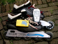
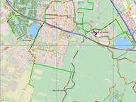
While skating, GPS position data is collected and published to a server through a mobile phone. At the same time the skater can enrich the data with road surface ratings (road quality is entered as a number (1-5) on the phone keypad) and by submitting pictures, songs, texts or videos. The server will draw geographic maps showing road quality through colouring plus the submitted media on the GPS locations where they were captured. In addition, skaters can also be seen moving in real-time on the map while skating.
Developed by Just van den Broecke.
Via locative.