
Navitime Japan has added aerial photo maps to its personal walking/car route-finder mobile phone app. For better precision, it features real shapes and scenery as well as high-res and low-altitude (rather than satellite) pictures.
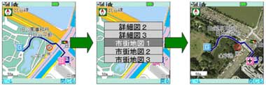
Traffic jam information can also be displayed live. Maps can be scrolled, zoomed in and rotated like the vector maps.
Details in IN-duce.