
When Rebecca Anema goes snowboarding with her friends she sometimes looses sight of them. So she decided to make a social GPS to see where she is and where friends are in relation to the mountains.
The system combines a GPS map (altitude, longitude) with an x,y map (trail map, street address) and a social map (where friends are).
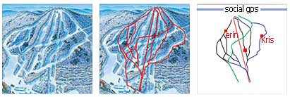
The J2ME application runs on GPS enabled phones. It communicates with the GPS to find out your location and sends the data to the database. It also checks who your buddies are and displays their location on your phone screen.
The system is useful anywhere people travel in a group.
The work will be presented at the ITP Spring show on May 10-11, in New York.