
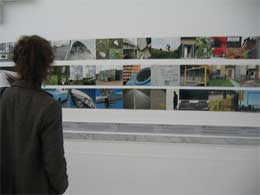
 I spent last Sunday in Genoa to attend Resistant Maps, artistic actions in the interconnected urban territory, a conference and exhibition that investigated the ‘resistant’ practices and theories related to the territory imaginary and how once can inoculate political viruses in the re-thinking of the space. It was a small, unaffected and friendly event but it was also one of the most stimulating and thought-provoking conferences i’ve attended this year. An unrelated note: i thought i was tired of Italian food but i had forgotten what a gastronomical fairyland the Ligurian region is.
The conference started with Alessandro Ludovico‘s introduction. Ludovico is a well-known media critic and the editor in chief of the magazine Neural since 1993. The publication was awared a Honorary Mention for Net.Vision at Prix Ars Electronica in 2004. One of the latest projects Ludovico has been collaborating to, Amazon Noir, is in the short-list of the upcoming Share festival.
His intervention was quite short as he only wanted to give some food for thoughts, some input for the upcoming reflection. He first explained how new technologies have re-defined our own perception of space. They include mobile telephony of course but also the now widely available mapping technologies. So far, the representation of territory was coming “from above”, it is still owned by governements and strictly protected in Europe. Maps have been freed in the US (that’s why an application like Google Maps could bloom.) Lorenzo Tripodi later added that if approved, a EU directive, INSPIRE, might further strengthen the States’ monopoly on geographical data.
Thanks to the apparition of these new technologies, maps are not granted anymore by structures of power, they are built by individuals who, drawing on the ideas of the psychogeographical movements, redraw the urban space according to fresh new coordinates. People can now share with others a more personal vision of geographical data (as opposed to the one traditionally in the hands of power.) Personal information can be added to the presentation of a given territory and thus come to be part of the collective memory.
Ludovico highlighted three tools that are representative of the opportunities that collaborative and locative technologies offer us today:
– Delocator, developed by Finishing School, an application that invites citizens to fight the homogenization of café culture imposed by franchised java providers.
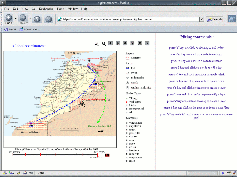
 – Google is the biggest operator on the net. They might provide us with cool mapping tools and applications but one must not forget that their first aim is commercial profit. MapOmatix is a free software developed by Hackitectura as a collaborative environment for creating and editing maps. The maps can contain physical elements (oil resources, telecomunication antennas,etc), abstract ones (such as human organisations, web servers) but they can also be used to emphasize relations between these entities. Behind this tool is the idea of editing and publishing tactical maps. See for example, their Deportations of African immigrants in Morocco map.
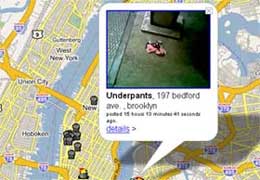
– GarbageScout that uses the API provided by Google Maps to point you to potentially useful things that have been thrown out in the street.
Next speaker was Lorenzo Tripodi who presented Cartografia Resistente, a project rooted in the territory of Florence. The work combines psychogeography, digital mapping and political activism. The idea stems from a desire to explore the territory “from below,” to offer other tools able to describe the territory, independently from the copy-righted geo data that government proposes. According to Tripodi, the economy of glabalization is a winning model in Florence. There’s very few voices that arise to express any oppostion.
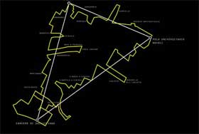 Cartografia Resistente is a wiki, it’s flexible and makes the process of sharing of information easier. There also a photo gallery. The group started to collect geographical data two years ago. Two characteristics of the project:
– The way the actors of Cartografia Resistente explore the city is inspired by the situationist practice of the Dérive, they walk without any agenda set, following the whim of the moment.
– Their focus is political, they aim to highlight the transformations that the city of Florence had to face over the past few years.
He ended his talk with a few considerations on the difficulty to sustain a budget-less project that relies only on the availability and energy of its users.
My images on flickr.