
Silicon Graphics Inc. is to collaborate with the U.S. Army on the Subterranean Target Identification program.
The program would allow soldiers to use seismic data from the Earth to help them feel out the presence of underground bunkers.
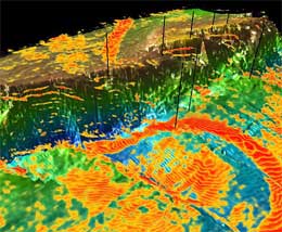
Right now, the military uses only satellite imagery of the Earth to search for “potential underground mischief.” Using the proposed program, the military would first scatter seismic sensors around the area to search, dropping them from the air or while on the ground. Then a soldier would shoot a rifle at a metal plate on the ground, causing reverberations anywhere from 20 to 200 feet into the ground.
The sensors would measure those reverberations and send data to supercomputers. Soldiers in the field would have access to the supercomputer system remotely through laptops or PDAs.
The software would automatically flag anything unexpected–a cave under the Earth’s surface, for instance–and prevent soldiers from having to synthesize complicated geophysical data.
Via Cnet News.