Atlas of the Conflict. Israel-Palestine, by Malkit Shoshan (available on amazon USA and UK.)
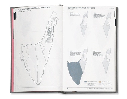
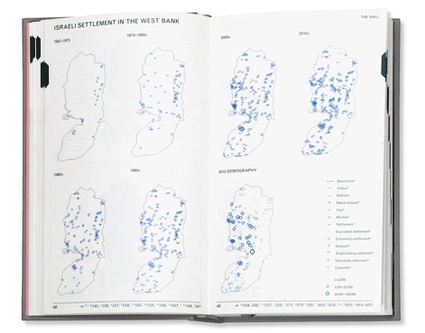
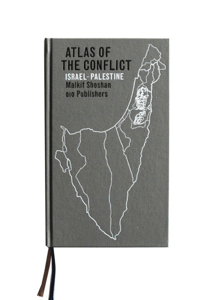 010 publishers writes: The Atlas of the Conflict maps the processes and mechanisms behind the shaping of Israel-Palestine over the past 100 years. Over 500 maps and diagrams provide a detailed territorial analysis of the Israeli-Palestinian conflict, explored through themes such as borders, settlements, land ownership, archaeological and cultural heritage sites, control of natural resources, landscaping, wars and treaties. A lexicon, drawing on many different information sources, provides a commentary on the conflict from various perspectives. As a whole, the book offers insights not only into the specific situation of Israel-Palestine, but also into the phenomenon of spatial planning used as a political instrument.
Malkit Shoshan is an Israeli architect. She is the founder and director of the Amsterdam based architectural think tank FAST whose research explores the relations between architecture, planning, politics and activism in Israel/Palestine, Georgia, Afghanistan, Iraq, Kosovo, and the Netherlands.
In her introduction, Shoshan explains that while studying at the Israel Institute of Technology, she was assigned to design a new program, preferably a shopping mall, on an empty plot near Tel Aviv. During her research, she discovered it to be a ruined Palestinian cemetery. From that day she started collecting illustrations, maps, photographs, diagrams and other visual materials about ‘a history that is not directly told.”
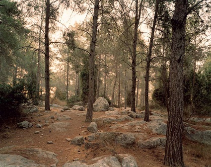 Adam Broomberg and Oliver Chanarin, Rabin Park, 2006. From Chicago
Her experience reminded me of an image from Adam Broomberg and Oliver Chanarin‘s book Chicago. The work takes its name a fake Arab town built in the Negev desert by the Israeli Defense Force for urban combat training, it also explores myths about the state of Israel. One of the photo series in the book shows biblically idyllic forests. Planted by Israel throughout the country, they have erased the Arab communities that once lived there.
The artists explain: For example, in our Forest Series we document pine forest in Israel that, since 1948, were systematically planted over the ruins of evacuated Arab towns. These forests look natural, as if they have been standing there forever. Our strategy here is to photograph the forests at the crack of dawn so the quality of light reinforces the feeling of harmless beauty, the myth of nature. Here we have appropriated conventions used in landscape painting, including the notion of the sublime and the picturesque. We wanted to show how the state of Israel has used these conventions, consciously or not, to stage or design a landscape that felt timeless and innocent, a landscape that would not only physically erase a recent violent history but would also suggest a natural and legitimate space. The forests seems to say that if anything evil exists here it must be in your imagination or subconscious.
Coming back to Atlas of the Conflict, i found its graphic design to be particularly efficient and elegant. Page after page. Even the compact and elongated size of the volume matches perfectly the territory explored in the book. Congrats to Joost Grootens for his awesome job!
The book is made of two part. One is made of some 300 pages of maps. The second part is the lexicon which through definitions, photos, graphics, a timeline and more maps attempts to reflect on the representation of various issues involved in the conflict. It was probably the easiest section for me to explore. Shoshan draws on material from sources that range from official statements of the Israeli government, to newspaper articles, wikipedia entries and even Malcolm X opinion about Zionism. Some of the key issues highlighted by author are the ones you expect: the Gaza Strip, land and property law in Israel, the Atorot airport, the difficulties faced by bedouins (check out this short doc that portrays this historically nomadic indigenous population and the way they are slowly uprooted from their culture and community.), smuggling tunnels, the Gaza freedom flotilla, refugees, Nakba, etc. Others however embrace the conflict from a more surprising but still relevant perspective: the donkeys dyed zebra in Gaza, images of propaganda leaflets dropped by Israeli aircraft on Lebanon, the notion of present absentees as well as a few architectural peculiarities. I was particularly intrigued by the images and structures of the caravillas. After the evacuation of the Gaza settlements in 2005, the Israeli government provided the evicted settlers with temporary lodgings made of two caravans, each forming half of a villa. Hence the name caravillas.
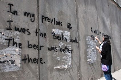 Image stolen from urbanizr
Now the first part of the book is a masterpiece when you think how difficult it is to map the territory covered by Palestine and Israel. Its borders are in constant flux. Its separation walls, settlements, parks and roads fragment space. The displacements, the destruction of whole villages, the building of new ones further complicate the picture. The maps seemed daunting and overwhelming at first but i quickly realized after having closed that part of the book that i had absorbed a valuable and impressive amount of information about the water dimension of the conflict, the fractured topography of Jerusalem, the various typologies of settlements and the way they shape the landscape, the many ways a piece of land or building can be appropriated, etc.
One thing i find important to note is that i don’t believe that the content of this book is as objective as it is claimed to be. The maps, photos and definitions might seem clean-cut and dry but you can nevertheless read through them. I would probably agree with Malkit Shoshan on many points about the Israel/Palestine situation but hers is not a neutral book. For example, i believe she chose her side when she decided to add to the lexicon “ethnic cleansing’ or the Malcolm X quote i mentioned above. But then how can one claim to be able to stay impartial when exploring in such detail the conflict (which i would personally prefer to define as ‘occupation’)?
Atlas of the Conflict is a fantastic tool kit for anyone interested in the history and contemporary situation of Palestine and Israel, but also in the way architecture, urbanism, transport infrastructure and even the humble pine tree can participate to power and domination.
Views inside the book:
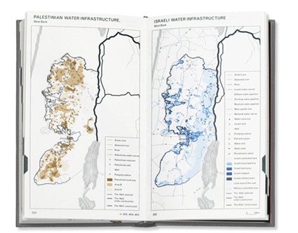
 PDF sample.
Image on the homepage via Stop the Wall.
Related stories: Decolonizing Architecture – Scenarios for the transformation of Israeli settlements, Israel vs Israel, Exhibition tip: GAZA 2010, Why do people desire walls?, Tip of the day – Welcome to Hebron.
And maps: Book review: The Map as Art, Contemporary Artists Explore Cartography, Book Review – Experimental Geography: Radical Approaches to Landscape, Cartography, and Urbanism and Book review: Hyper-Border: The Contemporary U.S.-Mexico Border and Its Future.
