As i wrote two months ago, i’ve been invited to curate the Digital Art a la Carte section for the upcoming Sonar, a festival of advanced music and multimedia art that will take place in June 15-17 in Barcelona. Digital Art a la Carte consists of works that can be shown on a computer screen. This year’s theme is Google Earth and Google Maps Hacks.
Selecting the works was harder than i expected. There’s plethora of Google Map hacks as the Google Maps Mania blog demonstrates every day but there aren’t that many projects that explore the possibilities of Google Maps under an artistic perspective. Not because artists are slow to jump on the bandwagon. They just didn’t wait for Google to engineer the tools that would re-invent our experience of topography.
I’m not only referring to the Locative Media trend which emerged over the last half decade but also to works that anticipated, well ahead of their time, what Google Earth would one day be. In 1994 already, ART+COM came up with Terravision, an installation that enabled users to navigate –topographically but also chronologically– in a 3D model of the globe by moving a tracking device in front of a projection of the Earth.
And as early as in 1987, Michael Naimark‘s Golden Gate Fly-over allowed users to navigate around the San Francisco Bay Area at fast speeds using images filmed by a gyro-stabilized helicopter camera and satellite navigation.
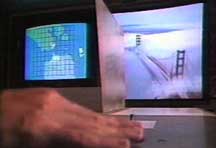
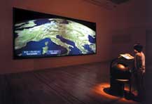 Golden Gate Fly-over and Terravision
Back to the selection. The ever astute Oscar Abril Ascaso had already picked up for another Sonar section the well-known Yellow Arrow but also one of my favourite projects ever: Christian Nold‘s Biomapping which i discovered two years ago at Futuresonic in Manchester. Another bummer was that following my call for projects, many artists sent me a few lines about their projects. Most of them, alas!, were awesome but still in the “in progress” stage.
So what was left that i really liked?
Surreal Scania for its pure and beautiful and dreamlike imaginary; GarbageScout because it makes me smile and because i like the idea that a man’s garbage could become a treasure for someone else; Blue Puddle because it’s been developed by a bunch of ingenious young guys who came up with application that range from a mapping of Free electricity outlets in public space to the documentation of a dance performance that used GPS technology; Satellite Jockey because i thought its use of google earth as turntables or a video mixer would humor the Sonar crowd; delocator for its fight against the homogenization of café culture by corporate java providers; OpenStreetMap because as their website says “we need a free dataset which will enable programmers, social activists, cartographers and the like to fulfil their plans without being limited either by Google’s API or by their Terms of Service.”
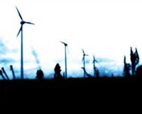
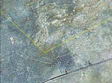 Surreal Scania and Satellite Jockey
Last project i selected is OGLE by Eyebeam R&D that allows for the capture and re-use of 3D geometry data from 3D graphics applications. I’d like to comment more on it because 1). i think it’s a pretty clever application, 2). it’s been less blogged around than the projects i mentioned above.

OGLE makes available for re-use the 3D forms we see and interact with in 3D applications: video gamers might like to use it to materialize their favorite characters; animators may wish to reuse environments or objects from other applications or animations which don’t provide data-level access; architects could use the application to bring 3D forms into their proposals and renderings; and digital fabrication technologies make it possible to automatically instantiate 3D objects in the real world. I found the 3D buildings OGLE’d from Google Earth very neat.
Let’s end with a few projects i like a lot but didn’t or couldn’t select for some reason:
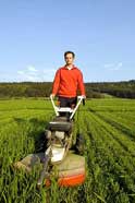
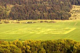
For his Hello World project, Bernd Hopfengärtner has been cutting a semacode of the size 170 x 170 meters into a wheat field (images).
The code consists of 18 x 18 dark and bright pixels that encode the words Hello, world!. The ambition of the project is to have an areal view of the code integrated in Google Earths’ regular database but also to comment Google Earth as a phenomenon that embodies the ambiguity of modern technologies.
A while ago, the King of ASCII himself sent me a link to ASCII Maps, a mashup that takes Google Maps and converts it into colored ASCII text.

Finally, a net.art work that isn’t based around Google Maps, but merely uses it as an additional tool. Eternal Sunset, by Adriaan Stellingwerff, creates the experience of an eternal sunset throught the use of existing (west-facing) webcams all around the world. As the sunset moves westward, Eternal Sunset continuously tunes into different webcams, chasing the sunset around the globe.


